Urban Flooding: How Cities Become Flood Traps
Cities can flood without a river overflowing. Pavement, drainage systems, low-lying streets and intense rainfall can turn ordinary neighborhoods into temporary flood traps.
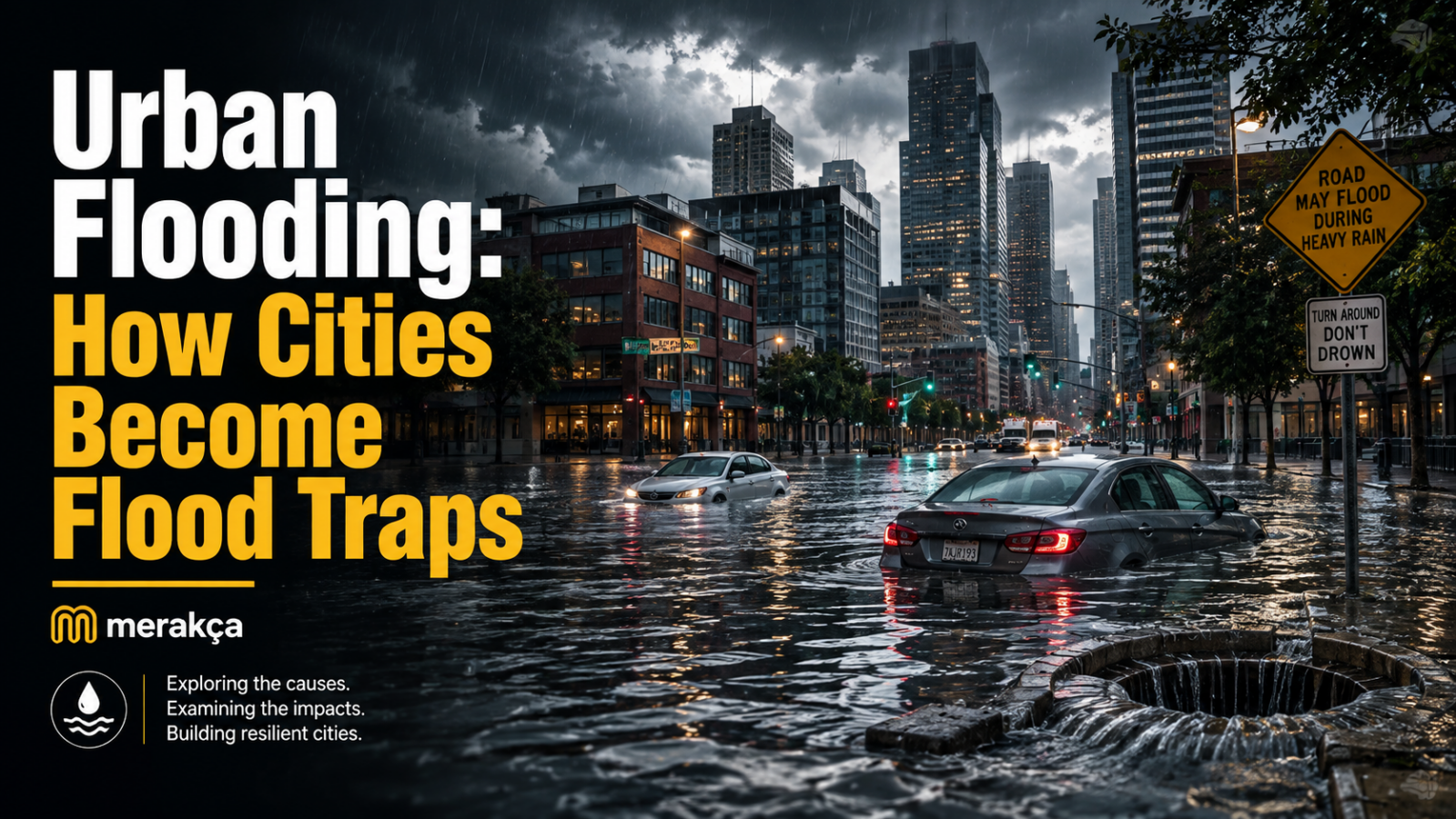
A storm does not need a river to burst its banks before a city starts flooding.
Sometimes the rain simply has nowhere to go.
Water falls onto rooftops, streets, sidewalks and parking lots, races toward drains, collects in low-lying intersections and begins rising around cars, buildings and underground spaces. Within a short time, streets designed for traffic can start behaving like temporary streams.
This is urban flooding, and the built environment can make it happen surprisingly fast.
Cities do not merely sit beneath rainstorms. Their surfaces, drainage networks, building patterns and geography determine what happens to the water after it lands. When rainfall arrives faster than the urban system can absorb, store or remove it, ordinary streets can become flood traps.
The Problem Starts With a Surface That Cannot Absorb Water
Imagine the same rain falling on two pieces of land.
One is covered with soil, grass, trees and vegetation. Some water stays on leaves, some sinks into the ground, some evaporates, and some eventually reaches nearby streams.
The other is a dense city block covered with asphalt, concrete, rooftops and sidewalks.
Much less water can soak into the ground.
Instead, it stays on the surface and begins moving.
Urban planners and hydrologists call roads, roofs, parking lots and similar materials impervious surfaces because water cannot easily penetrate them. The U.S. Environmental Protection Agency notes that urbanization increases both the amount and speed of stormwater runoff by replacing absorbent landscapes with these hard surfaces.
That difference turns a simple rainstorm into a transportation problem for water.
The city suddenly has to move enormous amounts of it somewhere else.
A City Can Become a Giant Funnel
Pavement does more than prevent infiltration.
Urban infrastructure actively directs water.
Curbs push it along streets. Gutters collect it. Sloped roads send it downhill. Storm drains pull it underground. Pipes concentrate runoff that was previously spread over a much larger area.
Under ordinary conditions, this system is useful. Without drainage infrastructure, even moderate rainfall could leave streets waterlogged.
Trouble begins when water arrives faster than the system can carry it away.
A drain has a limited capacity. So does a pipe. So does a pumping station.
Once that capacity is exceeded, the water does not disappear.
It begins looking for another route.
That route may be across a road, through a parking garage entrance, down a subway stairway or toward the lowest point in a neighborhood.
This is one reason urban flooding can appear suddenly even when there is no major river nearby.
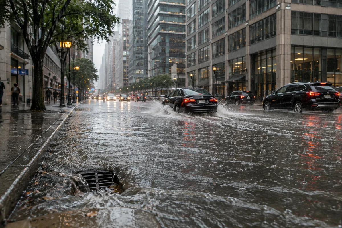
The Lowest Places Become Natural Collection Points
Water follows gravity whether a city planned for it or not.
Low-lying roads, underpasses, tunnels, basements and depressions in the landscape can become collection zones when drainage cannot keep up.
An intersection that seems completely ordinary on a dry day may sit slightly lower than the surrounding blocks. During intense rainfall, runoff from several streets can converge there.
The difference in elevation may be difficult to notice from the sidewalk.
For water, it matters enormously.
This also explains why flooding can be extremely uneven across a city. One neighborhood may experience only deep puddles while another, perhaps only a few blocks away, sees vehicles surrounded by water.
Urban flood risk is often intensely local.
The same is true of another urban environmental problem: heat. Curiworld’s look at why some neighborhoods are hotter than others shows how pavement, vegetation and land use can produce dramatically different conditions within the same city.
Those same differences in land cover can influence what happens when rain arrives.
More Drains Do Not Automatically Solve the Problem
It seems logical that a flood-prone city simply needs more drains.
Sometimes additional drainage capacity is exactly what is needed. But urban flooding is rarely that simple.
A drainage network is a system.
Water must enter the drains, move through pipes or channels and eventually reach somewhere capable of receiving it. Expanding one part of that network without considering the rest can simply move the bottleneck.
Maintenance matters too.
Leaves, trash, sediment and debris can reduce the ability of drainage entrances to accept water. Older infrastructure may also have been designed for development patterns very different from the city that exists today.
A neighborhood that once contained gardens and open land may now contain apartment buildings, roads, parking areas and commercial developments.
The storm may be similar.
The amount of water reaching the drainage network can be very different.
Urban Growth Can Quietly Increase Flood Risk
A city does not need to build directly on a river to change its flood behavior.
Every new paved surface alters how rainfall moves through the landscape.
A field becomes a housing development.
A garden becomes a parking lot.
Open ground becomes a warehouse.
A dirt path becomes a road.
Individually, each change may appear minor. Across an expanding metropolitan area, they can dramatically increase the amount of impervious surface.
The Intergovernmental Panel on Climate Change identifies urban expansion and land-use change as important contributors to urban flood risk because soil sealing increases runoff and can make drainage and sewer overflows more likely.
One example summarized by the IPCC is especially revealing. Modeling for Hohhot, China, found that increasing impervious surfaces contributed substantially more to modeled annual flood risk than climate change in that particular case.
That does not mean urban development is always more important than climate change.
It shows something more useful:
A city’s flood risk is shaped not only by the weather it receives, but by what the city has built beneath that weather.
Climate Change Can Add More Water to an Already Difficult Equation
Urbanization and climate change are different processes, but they can reinforce each other.
A heavily paved city already produces rapid runoff.
If that city also experiences more intense extreme rainfall, more water may arrive during the same short period.
The result is a capacity problem.
A drainage system does not care whether the rainfall intensity came from an unusual storm, changing climate conditions or natural variability. It only has to cope with the volume arriving at its entrances.
The IPCC reports that continued warming is expected to increase urban flooding risks in many places, although the magnitude and type of risk vary substantially by region.
This distinction matters because climate change should not become a catch-all explanation for every flooded street.
Some urban floods are primarily infrastructure problems.
Others involve unusually intense rainfall.
Some are worsened by development in low-lying areas.
Coastal cities can face additional risks from high sea levels and storm surge.
In many cases, several factors occur together.
Urban Flooding Is Not the Same as River Flooding
The word flood can describe several different processes.
River flooding occurs when water exceeds the capacity of a river or stream and spreads into surrounding land.
Coastal flooding can result from high tides, storm surge, waves and rising sea levels.
Urban surface flooding — often called pluvial flooding — can occur when intense rainfall overwhelms the ability of the ground and drainage system to handle the water.
That distinction explains why a neighborhood can flood even if it is miles from a large river.
The water does not necessarily need to arrive from somewhere else.
It can fall directly onto the city.
Cities built beside rivers face additional complexity because river flooding and urban drainage problems can sometimes interact. Rivers themselves are dynamic systems, as Curiworld explores in Why Do Some Borders Follow Rivers?, but an urban flood does not require a river to move beyond its banks.
The Same Asphalt Can Contribute to Both Heat and Flooding
There is an interesting connection between two problems that are usually discussed separately.
Urban heat and urban flooding can share some of the same physical causes.
Large areas of pavement and rooftops absorb and store solar energy, helping developed areas remain warmer than greener surroundings. Curiworld explores this process in Cities Stay Hot After Sunset: The Urban Heat Island Effect Explained.
During rain, many of those same surfaces create a different problem.
They cannot absorb much water.
So a city dominated by hard surfaces can struggle in opposite weather conditions:
during hot, dry periods, those surfaces can contribute to excessive heat;
during intense rainfall, they can accelerate runoff.
This is why adding vegetation and permeable areas can sometimes provide several environmental benefits rather than solving only one problem.
Cities Are Beginning to Make Room for Water Again
Traditional stormwater engineering often focused on removing water as quickly as possible.
Newer approaches increasingly ask another question:
What if some of the water never had to enter the drainage system in the first place?
Green infrastructure is designed to capture, slow, store or absorb rainfall closer to where it lands.
Depending on local conditions, this can include:
- rain gardens that temporarily collect runoff;
- permeable pavement that allows some water to pass through;
- vegetated roofs;
- planted roadside areas and bioswales;
- restored wetlands;
- additional trees and green spaces;
- detention and retention areas that temporarily store stormwater.
The EPA describes these approaches as ways to preserve or reproduce more natural water processes inside developed environments.
They are not magic solutions.
Soil conditions matter. Maintenance matters. Available space matters. Rainfall intensity matters. A rain garden cannot compensate for every extreme storm, and permeable pavement is not suitable for every street.
But the basic principle is powerful:
Instead of treating every raindrop as something that must immediately be pushed into a pipe, a city can create places where water is allowed to slow down, spread out, soak in or wait.
Sometimes the Best Flood Infrastructure Does Not Look Like Infrastructure
A large underground pipe obviously looks like flood-control infrastructure.
A park may not.
Yet a well-designed green space can temporarily hold water that would otherwise move toward streets and drains.
A row of planted areas beside a road may intercept runoff.
A wetland can provide storage.
A permeable surface can allow part of a storm to move downward rather than sideways.
This represents a broader change in how cities think about water.
For centuries, urban development often treated rain as something to remove.
Flood-resilient planning increasingly treats water as something that also needs space.
That difference becomes important as cities grow denser and natural surfaces disappear.
A Flood Trap Is Built One Surface at a Time
Urban flooding can look like a weather disaster, but the storm is only part of the story.
Rain falls.
Then the city decides what happens next.
A tree-covered landscape can intercept and absorb some of that water. A parking lot cannot. A low-lying street collects runoff differently from higher ground. A modern drainage system behaves differently from an overloaded one. A neighborhood with parks, permeable surfaces and stormwater storage responds differently from one covered almost entirely in roofs and pavement.
That is why two cities can experience similar rainfall and suffer very different consequences — and why two neighborhoods inside the same city can flood differently during the same storm.
Cities become flood traps when water can enter faster than it can escape.
The most resilient cities therefore do more than build bigger drains.
They give water more than one place to go.
Sources
U.S. Environmental Protection Agency — Urbanization and Stormwater Runoff
https://www.epa.gov/sourcewaterprotection/urbanization-and-stormwater-runoff
Intergovernmental Panel on Climate Change — Climate Change 2022: Impacts, Adaptation and Vulnerability, Chapter 6: Cities, Settlements and Key Infrastructure
https://www.ipcc.ch/report/ar6/wg2/chapter/chapter-6/







Join the discussion