Why Do Some Borders Follow Rivers?
Rivers look like obvious country borders—until they move, split, or create islands. Here’s how governments turn changing waterways into legal boundaries.
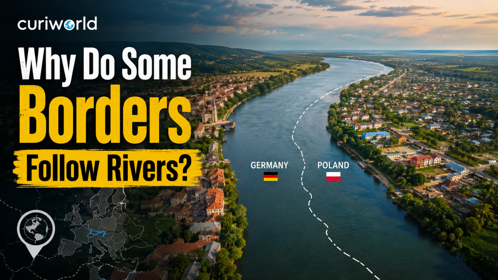
Look at a political map and rivers often seem to double as borders.
The Rio Grande separates long stretches of the United States and Mexico. Elsewhere, rivers divide provinces, states, kingdoms, and countries.
It seems almost obvious: if two territories need a boundary and a large river already runs between them, why invent another line?
That logic has shaped borders for centuries.
Rivers are visible, difficult to ignore, useful for navigation, and often already separate settlements or landscapes. But calling them “natural borders” can be misleading.
A river may look permanent on a map.
The river itself is anything but fixed.
It can migrate, split into channels, create islands, erode one bank, build another, or suddenly abandon its old course.
So whenever a treaty says “the border follows the river,” another question immediately appears:
Which part of the river?
Rivers Give Negotiators Something Everyone Can See
Before satellites, GPS, and detailed national mapping, defining a border across remote territory could be extremely difficult.
A treaty saying:
“Follow the river north until it reaches the mountains”
was far easier to understand on the ground than a boundary based on an invisible coordinate.
Rivers could therefore provide convenient reference lines.
They were already mapped.
Travelers could find them.
Surveyors could identify them.
Local communities often knew exactly where they were.
That made a river attractive compared with an imaginary line running through forests, plains, or other difficult terrain.
The principle connects directly with Curiworld’s explanation of why some countries have such straight borders. Where governments lacked a useful physical feature, they sometimes relied on latitude, longitude, or straight surveyed lines instead.
A river offered the opposite solution: let the landscape provide the basic route.
Rivers Can Also Form Real Barriers
A large river does more than create a line on a map.
Historically, crossing it could require boats, bridges, ferries, favorable weather, or controlled crossing points.
That made major rivers strategically useful.
An army on one bank did not always move easily to the other.
Trade could be concentrated at particular crossings.
Settlements sometimes developed differently on opposite sides.
Governments could monitor movement more easily at a bridge or ferry than across hundreds of miles of open countryside.
This did not make rivers impossible to cross.
But compared with an arbitrary line through a plain, a wide river could provide a practical geographic separation.
But Where Exactly Is the Border Inside the River?
This is where the apparently simple idea becomes complicated.
Suppose Country A occupies one bank and Country B the other.
Who owns the water?
There are several possibilities.
The boundary might follow the geographic middle of the river.
It might follow one bank, leaving almost the entire river under one country’s sovereignty.
Or, for a navigable river, it may follow something called the thalweg.
The thalweg is one of the most important—and most misunderstood—ideas in river boundaries.
What Is the Thalweg?
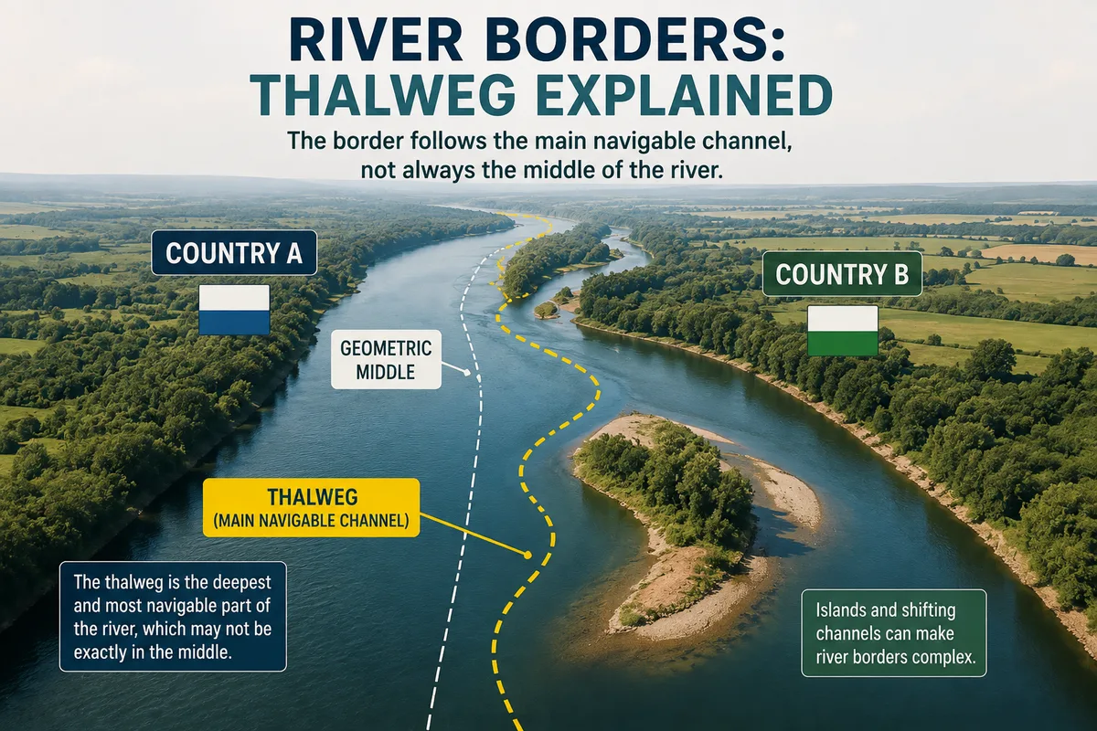
There is no single perfectly universal definition, but in international boundary practice the thalweg generally refers to the main navigable channel of a river.
It may be described using ideas such as:
- the main channel;
- the line of deepest soundings;
- or the most suitable route for navigation.
Why not simply divide the river exactly down the middle?
Because the useful navigation channel may not run through the geometric center.
Imagine a wide river where deep water flows close to the eastern bank.
If the border followed the exact midpoint, the main shipping route might fall almost entirely within one country.
Using the navigable channel as the boundary can help avoid giving one side exclusive control over the river’s most useful route.
This is why international agreements involving navigable rivers frequently pay close attention to channels rather than merely measuring the distance between the banks.
The thalweg is not one universal mathematical rule applied identically to every river border.
International agreements have used the term in somewhat different ways, including the principal navigable channel or a line associated with the deepest or main channel.
The exact legal boundary therefore depends on the treaty or agreement that created it.
A useful rule of thumb is that navigable rivers have often used some version of the main navigation channel, while non-navigable river boundaries may use a median line—but real treaties can define the boundary differently.
One Island Can Make the Whole Question Difficult
A river does not always have one channel.
It can divide around islands.
Now imagine the border treaty says that the international boundary follows the main channel.
Which side of the island contains the main channel?
That exact kind of question reached the International Court of Justice in a dispute between Botswana and Namibia involving Kasikili/Sedudu Island in the Chobe River.
The river divided into channels around the island.
The Court had to determine which channel represented the relevant boundary under an 1890 agreement.
In its 1999 judgment, the Court concluded that the border followed the line of deepest soundings in the northern channel, placing the island on Botswana’s side.
A river may therefore look like an obvious boundary from space while still producing years of legal argument over a few channels.
The Rio Grande Shows the Biggest Problem: Rivers Move
The Rio Grande forms a large portion of the international boundary between the United States and Mexico.
According to the International Boundary and Water Commission, the international boundary follows the river’s centerline for approximately 1,255 miles between the Gulf of Mexico and the El Paso–Ciudad Juárez area.
But the river has not always stayed in exactly the same place.
Flowing water erodes soil from one bank and deposits sediment on another.
Over time, the channel can gradually migrate.
Sometimes the change is dramatic.
This creates an unusual sovereignty problem.
If the river moves, did the international border move with it?
Sometimes the Border Moves—and Sometimes It Doesn’t
International law has traditionally distinguished between different types of river change.
A gradual change caused by erosion and deposition may allow a river boundary to shift with the channel under the rules governing that particular border.
A sudden change—often called avulsion—can be treated differently.
Imagine a flood cuts a completely new channel overnight.
If sovereignty automatically followed every sudden change, a single flood could transfer farms, buildings, roads, and entire areas from one country to another.
That would create enormous uncertainty.
This is why river-border treaties often include specific rules explaining what happens when the water moves.
There is no useful universal rule that can be applied to every international river without first checking the treaty governing that boundary.
The river provides the geography.
The treaty provides the law.
A Moving Rio Grande Once Created a Real Territorial Dispute
One of the most famous examples occurred between El Paso, Texas, and Ciudad Juárez, Mexico.
During the nineteenth century, movement of the Rio Grande altered the physical geography around an area known as Chamizal.
The question of whether the shifting river had also shifted sovereignty developed into a long-running dispute between the United States and Mexico.
It was not finally resolved until the twentieth century.
The International Boundary and Water Commission later helped implement the 1963 Chamizal Convention, including relocating and stabilizing part of the river channel.
The episode reveals the central weakness of river borders:
A political boundary seeks permanence.
A river does not.
Why Not Put the Border Somewhere Away From the River?
That can happen.
But doing so creates other problems.
A boundary running several miles from the water might divide settlements awkwardly or leave one country controlling both banks.
It could also complicate access to navigation, irrigation, fishing, or transportation.
And if both states already recognize the river as the obvious division between their territories, moving the legal line elsewhere may solve one problem while creating several others.
That is why governments often keep the river as the boundary and create detailed agreements for managing its movement.
Does a River Border Mean Each Country Owns Half the Water?
Not automatically.
Territorial boundaries and water rights are related but separate questions.
Two countries can share a boundary river while operating under treaties governing:
water withdrawals;
dams;
irrigation;
navigation;
pollution;
flood control;
fishing;
and water allocation.
A border determines where territorial jurisdiction changes.
It does not, by itself, answer every question about how the river’s water may be used.
This distinction becomes especially important in dry regions, where the river itself may be economically more valuable than the territory immediately beside it.
Rivers Can Connect Countries as Much as They Divide Them
Political maps encourage us to see a river boundary as a separator.
Historically, rivers have also been major transportation routes.
Cities grew beside them.
Goods traveled along them.
Fishing communities depended on them.
People on opposite banks traded with one another.
So a river can perform two seemingly contradictory roles at the same time:
It can mark where one country’s sovereignty ends while physically connecting communities on both sides.
That is one reason international river boundaries often require unusually close cooperation.
Neither country can control what the river does entirely from its own bank.
Pollution released upstream crosses political lines.
Floods ignore customs posts.
Changes in water flow affect everyone downstream.
The border divides jurisdiction.
The water remains connected.
Are River Borders Really More “Natural” Than Straight Borders?
Visually, yes.
Politically, not necessarily.
A river existed before diplomats decided to make it an international boundary.
But nature did not decide that the western bank belonged to Country A and the eastern bank to Country B.
People did.
They also decided:
which river to follow;
which channel counted;
whether the midpoint or thalweg should be used;
what happened around islands;
and whether the border should move when the river moved.
So the phrase natural border can hide a surprising amount of political engineering.
The river may be natural.
The border is still a human decision.
Rivers Make Convenient Borders—Until They Behave Like Rivers
There is a reason rivers appear so often on political maps.
They are visible, recognizable, strategically important, and historically easier to identify than invisible geometric lines.
But their usefulness comes with a contradiction.
Governments want boundaries to be stable.
Rivers are dynamic systems.
They erode.
They deposit sediment.
They split.
They migrate.
They flood.
They create and destroy islands.
That is why a line that looks perfectly obvious on a world map may require treaties, surveys, engineers, courts, and international commissions to determine where it actually lies.
A river can tell two countries roughly where their territories meet.
Only an agreement can decide exactly what that means.
Sources
International Court of Justice — Kasikili/Sedudu Island Judgment and Thalweg Discussion




Join the discussion