What Is an Enclave and an Exclave? The World’s Strangest Examples
A piece of Belgium inside the Netherlands—and Dutch territory inside that? Enclaves and exclaves reveal just how strange political geography can become.
Most countries look reasonably tidy on a map. Their territory forms one connected shape, bordered by neighboring states or the sea.
Then you find Baarle.
Part of Belgium sits inside the Netherlands. Inside some of those Belgian pockets are tiny pieces of the Netherlands again. Elsewhere, a Spanish town is surrounded by France, an Italian municipality sits inside Switzerland, and in the Arabian Peninsula there is even a piece of one country trapped inside a piece of another country that is itself surrounded by the first.
Political geography has names for these territorial puzzles: enclaves and exclaves.
They sound similar, but they describe the map from different perspectives.
Enclave vs. Exclave: What Is the Difference?
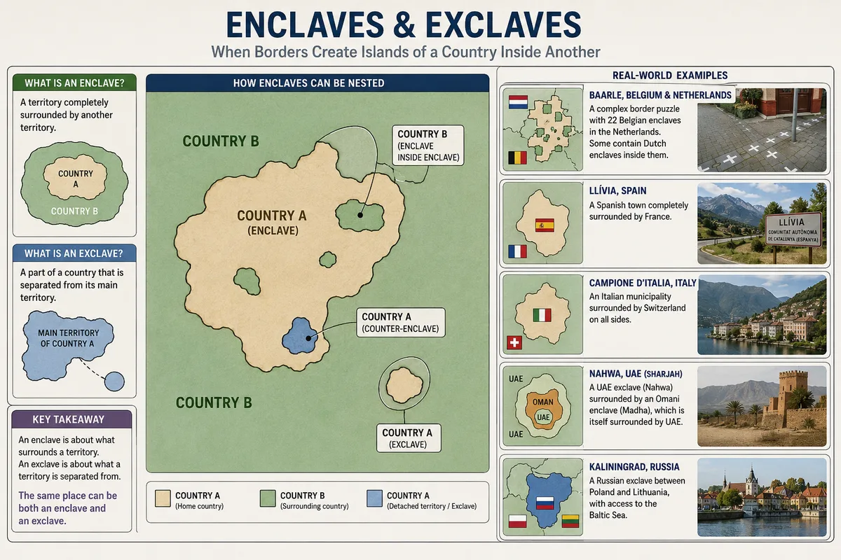
An enclave is a territory completely surrounded by another territory. An exclave is a part of a country that is geographically separated from its main territory. A place can be both an enclave and an exclave if it is detached from its country and completely surrounded by another country.
Consider a small piece of Country A completely surrounded by Country B.
From Country B’s perspective, that territory is an enclave.
From Country A’s perspective, it is an exclave because it is detached from the rest of Country A.
A simple way to remember it: an enclave is defined by what surrounds it, while an exclave is defined by being separated from the main territory of its country.
Not every exclave is an enclave. A detached territory that borders several countries or has access to the sea may qualify as an exclave without being completely enclosed by one neighboring state.
That distinction becomes important when looking at places such as Kaliningrad.
Baarle: Where Belgium and the Netherlands Become a Puzzle
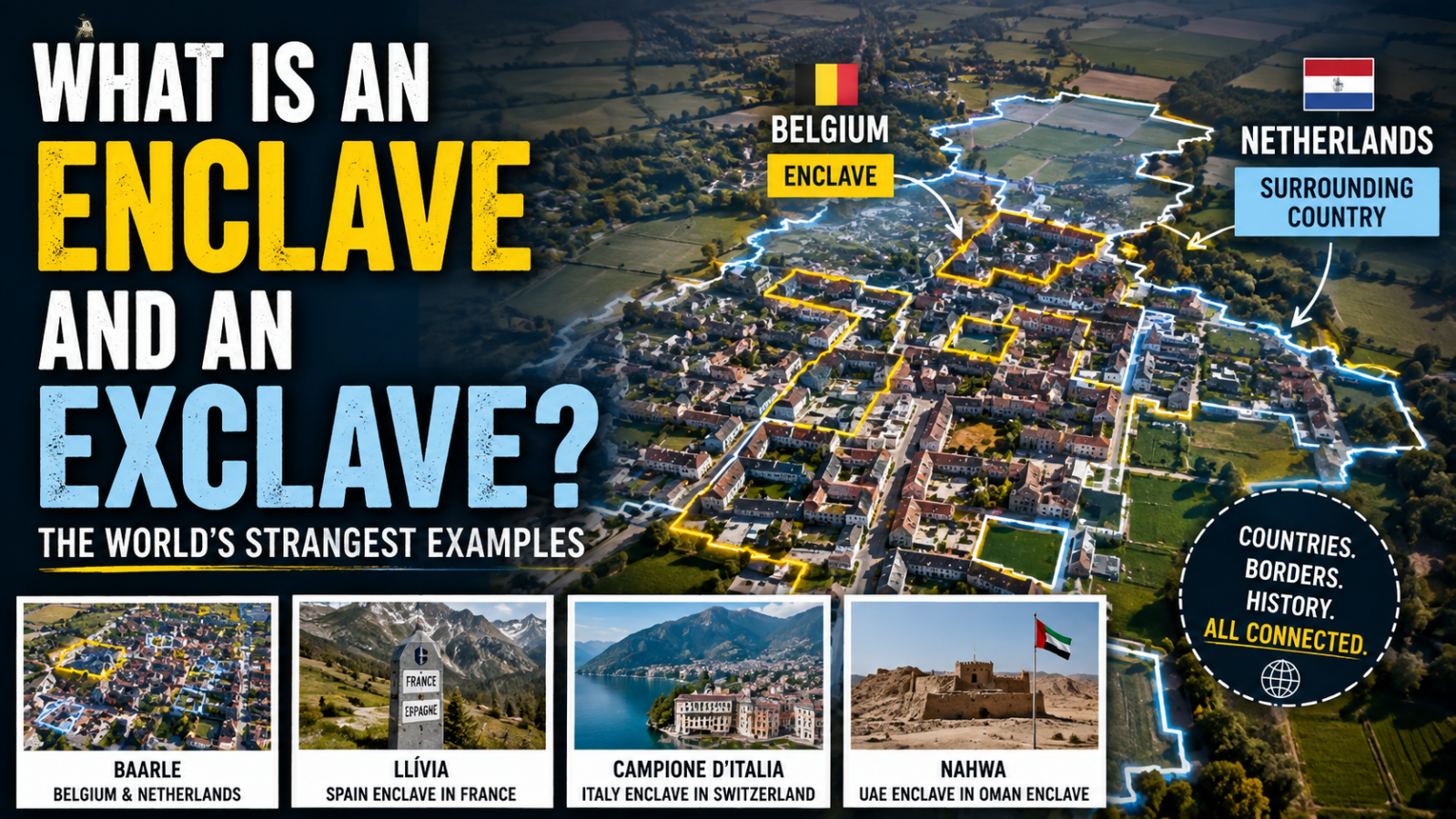
The world’s most visually spectacular enclave system may be found in the town of Baarle.
Baarle-Hertog belongs to Belgium.
Baarle-Nassau belongs to the Netherlands.
Simple enough—until you look at the map.
The municipality of Baarle-Hertog says 22 Belgian enclaves are completely surrounded by Dutch territory. Inside the two largest Belgian enclaves are seven Dutch enclaves, while another Dutch enclave lies within Belgium farther south.
Together, the municipalities describe Baarle as a puzzle involving 30 enclaves.
The borders are not hidden in forests or distant mountains.
They run through an inhabited town.
International boundary markings cross streets and properties, and some buildings sit across both countries.
The result looks less like a conventional border and more like someone dropped pieces of Belgium into the Netherlands and then placed several Dutch pieces back inside them.
Yes, There Can Be an Enclave Inside an Enclave
This brings us to one of political geography’s strangest terms: the counter-enclave, sometimes called a second-order enclave.
Imagine this:
Country A contains an enclave belonging to Country B.
Inside that enclave is another piece of Country A.
The territory has effectively gone:
A → B → A.
Baarle contains examples of this arrangement.
But perhaps the cleanest modern example is Nahwa.
Nahwa belongs to the Emirate of Sharjah in the United Arab Emirates.
It is surrounded by Madha, which belongs to Oman.
Madha itself is surrounded by the United Arab Emirates.
So to travel overland from the main UAE into Nahwa, you enter an Omani enclave and then re-enter a UAE enclave inside it.
It is a geographical nesting doll.
Llívia: A Piece of Spain Surrounded by France
In the Pyrenees sits another classic example.
Llívia belongs to Spain but is completely surrounded by French territory.
Administratively, it is part of Catalonia.
Geographically, however, it is detached from the rest of Spain.
That makes Llívia both an enclave from France’s perspective and an exclave from Spain’s.
Places like Llívia are reminders that modern borders often preserve decisions made centuries ago.
When territories change hands through treaties, inheritance, war, land exchanges, or negotiations, not every small parcel fits neatly into the new national map.
Sometimes the odd piece survives.
Centuries later, what once made sense in a treaty can look thoroughly bizarre on Google Maps.
Campione d’Italia: Italy Inside Switzerland
A similar arrangement exists beside Lake Lugano.
Campione d’Italia is an Italian municipality surrounded by Swiss territory.
Politically it belongs to Italy’s Province of Como, yet reaching the main part of Italy by land requires passing through Switzerland.
The municipality itself officially describes Campione as an Italian exclave surrounded by Swiss territory.
Again, the interesting part is not merely its unusual shape.
An exclave forces ordinary local matters—transport, public services, taxation, customs, emergency access, commuting—to interact with an international border.
A line on a map becomes part of everyday life.
Is Kaliningrad an Enclave or an Exclave?
Russia’s Kaliningrad region demonstrates why the words enclave and exclave should not simply be treated as synonyms.
Kaliningrad is geographically separated from the main territory of Russia.
It therefore functions as an exclave.
But it is not completely surrounded by one foreign country. It borders both Poland and Lithuania and also has a Baltic Sea coastline.
Under stricter geographic classifications, that makes it different from a true enclave such as Llívia or Campione.
You will sometimes encounter terms such as semi-enclave or semi-exclave for territories with sea access or other unusual configurations.
Definitions vary slightly between geographical classifications, which is why it is useful to focus on the underlying relationship rather than memorizing every specialist label.
Kaliningrad is detached from Russia.
Llívia is detached from Spain and enclosed by France.
Those are different geographical situations.
Which Countries Are Enclaves?
Enclaves do not have to be small pieces of another country.
Sometimes the entire sovereign state is surrounded by one neighbor.
Three famous examples are:
- Vatican City, surrounded by Italy;
- San Marino, also surrounded by Italy;
- Lesotho, completely surrounded by South Africa.
These are often described as enclaved states.
Lesotho is particularly striking on a world map because an entire independent country—with its own government, borders, population, and international relations—sits entirely inside another sovereign state.
The map may look unusual, but politically Lesotho is no less independent because of its geography.
Why Do Enclaves Exist in the First Place?
Almost nobody would design a modern political map from scratch and deliberately produce something like Baarle.
That is the clue.
Enclaves are usually historical leftovers created by feudal land ownership, dynastic inheritance, wars and peace treaties, territorial exchanges, colonial boundaries, the breakup of larger states, or negotiations that preserved particular pieces of territory.
Medieval Europe was especially good at producing fragmented territories because political control did not always resemble the compact nation-states we expect today.
A noble might own one village, another ruler the fields around it, and a monastery a separate parcel nearby.
As larger states consolidated, most of these territorial fragments disappeared.
A few survived.
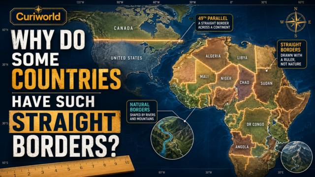
This connects directly with another strange feature of political maps. As Curiworld’s guide to why some countries have such straight borders explains, national boundaries are rarely products of geography alone. Rivers and mountains matter, but treaties, surveying, historical claims, colonial decisions, and political compromise matter too.
Enclaves are the extreme version of that principle.
Sometimes history leaves behind not just an unusual border—but an entire island of sovereignty.
Why Don’t Countries Simply Exchange the Land?
Looking at Baarle or Llívia, the obvious solution seems to be:
Why not swap a few pieces of territory and make the map normal?
Because land is not just geometry. People live there, own property, hold citizenship and depend on governments for roads, schools, policing, utilities, taxation and voting rights. Historical identity may also be strong, so changing sovereignty affects far more than the color of a territory on a map.
There is also a political problem.
Country A may be perfectly willing to give up one awkward enclave if Country B provides something equally valuable in return.
Country B may see no reason to agree.
So apparently inconvenient borders can survive for centuries because keeping them is easier than negotiating an acceptable replacement.
Enclaves Turn Local Problems Into International Ones
Living inside an enclave can create practical questions most people never have to consider.
Enclaves can turn ordinary local issues into international questions: which roads residents use, who maintains cross-border infrastructure, where emergency services come from, which customs rules apply and how people or deliveries move through the surrounding country.
Enclave geography therefore forces neighboring governments to cooperate in unusually local ways.
Baarle provides a good modern example. The Belgian and Dutch municipalities cooperate on areas including infrastructure, culture, safety, roads, and other services because their territories are too intertwined to operate as completely separate geographic worlds.
The border remains international.
Daily life has to work around it.
The Strangest Borders Usually Have Long Memories
Enclaves and exclaves look like mistakes because modern maps encourage us to expect countries to form clean, connected shapes.
History had no obligation to produce clean national shapes. Medieval land deals, treaties and the breakup of larger states can leave territories on unexpected sides of modern borders, and some enclaves become so established that changing them would create more problems than leaving them alone.
That is why the world’s strangest territorial puzzles are more than map trivia.
They reveal something fundamental about borders:
countries are not drawn once and finished. Their shapes are accumulated from centuries of political decisions—and sometimes the strangest decisions are the ones that survive.
Sources
Evgeny Vinokurov — A Theory of Enclaves — Lexington Books
View A Theory of Enclaves
Gemeente Baarle-Hertog — 30 Enclaves
View the official Baarle-Hertog enclave information




Join the discussion