The Strangest International Borders in the World
Enclaves inside enclaves, American communities reachable by road only through Canada, and a territory connected at one point—these borders make maps wonderfully strange.
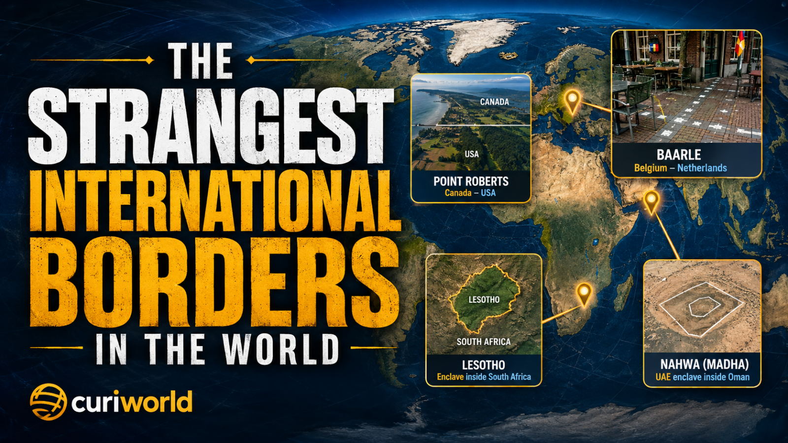
Most international borders are easy to ignore on a world map. A line follows a mountain range, crosses a plain, reaches the sea, and the neighboring country begins.
Then there is Baarle, where the Belgium–Netherlands border runs through streets and properties.
There is Point Roberts, an American community connected by land to Canada rather than the rest of the United States.
There is Nahwa, a piece of the United Arab Emirates located inside an Omani enclave that is itself surrounded by the UAE.
And there is an Austrian territory that touches the rest of Austria at essentially a single point.
These places look like cartographic mistakes.
They are not.
The world’s strangest borders are usually pieces of history that survived long enough to become geography.
Baarle: Where the Border Becomes a Jigsaw Puzzle
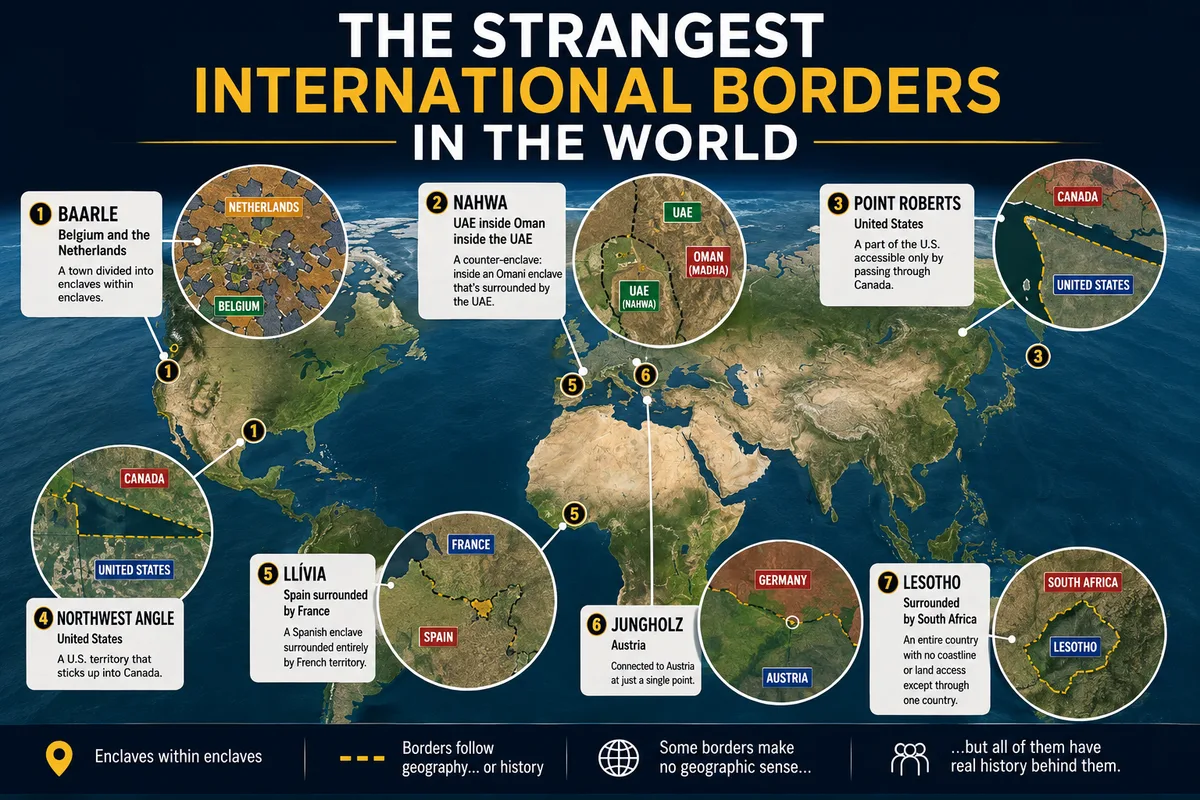
If someone deliberately tried to design the least convenient international border possible, the result might look like Baarle.
The Belgian municipality of Baarle-Hertog consists of 22 Belgian enclaves inside the Netherlands. Inside some of those Belgian pieces are Dutch enclaves belonging to Baarle-Nassau.
Together, the arrangement creates a patchwork of 30 enclaves.
The unusual part is not only visible on a political map.
The border passes through an inhabited town.
Properties, roads, gardens, and buildings sit beside—or sometimes across—an international boundary. White boundary markers embedded in streets and pavements make the political geography part of everyday life.
Yet Baarle functions.
The Belgian and Dutch municipalities cooperate on infrastructure, public services, safety, and other practical matters because geography gives them little alternative.
The border is bizarre.
Daily life has learned how to work around it.
Nahwa: An Enclave Inside an Enclave
Baarle is complicated.
Nahwa may be even harder to explain in one sentence.
Start with the United Arab Emirates.
Inside the UAE is Madha, a territory belonging to Oman.
Inside Madha is Nahwa, which belongs to the UAE again.
So the territorial sequence goes:
UAE → Oman → UAE.
Nahwa is what geographers call a counter-enclave: an enclave located inside another enclave.
To reach Nahwa overland from the main UAE, a traveler enters the Omani territory of Madha and then crosses back into UAE territory.
It resembles a geopolitical nesting doll.
The arrangement is rare because most states have spent centuries consolidating disconnected pieces of territory. Nahwa is one of the places where that cleanup never produced a simple map.
Point Roberts: The United States Below a Line
Point Roberts, Washington, demonstrates how a perfectly straight border can create a very strange result.
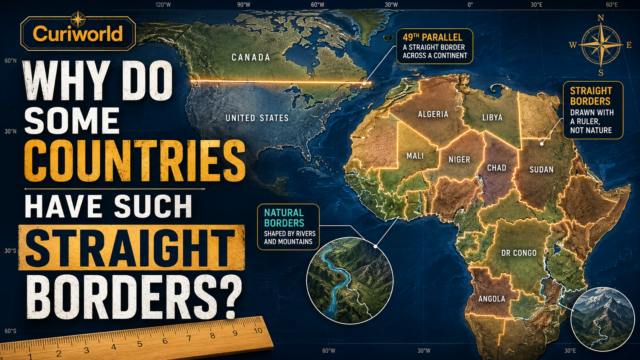
Much of the western Canada–United States boundary follows the 49th parallel north.
The problem is that geography does not arrange itself around latitude.
The 49th parallel cuts across the Tsawwassen Peninsula near Canada’s Pacific coast, leaving its southern tip on the American side of the line.
That tip is Point Roberts.
It belongs to Washington State, but it is not connected by land to the rest of the contiguous United States.
To drive from Point Roberts to another part of Washington, residents normally cross into British Columbia, travel through Canada, and then cross the international border back into the United States.
Nothing physically separates Point Roberts from Canada.
The oddity exists because a mathematical line was given political meaning.
It is a perfect real-world example of the problem explored in Curiworld’s guide to why some countries have such straight borders.
Sometimes the ruler is more powerful than the coastline.
The Northwest Angle: An American Piece Above the 49th Parallel
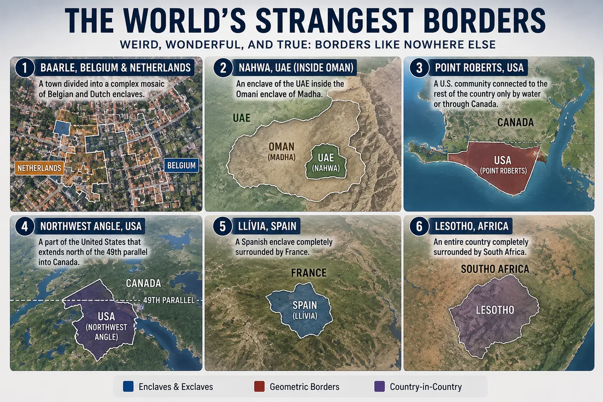
Point Roberts is not the only unusual piece of the United States created by the Canadian border.
Look at northern Minnesota and you will find the Northwest Angle protruding above the 49th parallel into Canada.
The explanation goes back to early boundary treaties and imperfect geographic knowledge.
Negotiators used the northwesternmost point of Lake of the Woods as an important reference for the international boundary. Later agreements connected that point to the 49th parallel.
The resulting geometry left a small portion of American territory north of the line that otherwise defines much of the western border.
The Northwest Angle is therefore connected to the rest of Minnesota, but ordinary road access to much of it involves traveling through Canada.
The shape looks irrational only if we assume the border was designed with a modern map in front of its creators.
It wasn’t.
Historical governments made decisions using the maps, surveys, and political priorities available to them at the time.
Today’s oddity is yesterday’s compromise.
Llívia: A Spanish Town Surrounded by France
In the Pyrenees, the town of Llívia belongs to Spain.
The territory surrounding it belongs to France.
That makes Llívia a Spanish enclave and exclave, separated from the main body of Spain by French territory.
Its unusual status is rooted in seventeenth-century diplomacy.
Territorial agreements transferred surrounding communities to France while Llívia remained Spanish.
What makes examples like Llívia fascinating is their persistence.
Modern governments could theoretically negotiate a territorial exchange and create a cleaner border.
But a border is more than a shape.
People have citizenship, property rights, municipal institutions, historical identities, and legal relationships built around it.
Once an unusual boundary survives for generations, removing the oddity can be more disruptive than preserving it.
Jungholz: Connected to Austria by Almost Nothing
Jungholz is Austrian.
Almost every piece of territory around it is German.
What prevents it from being a conventional Austrian enclave is extraordinary: Jungholz touches the rest of Austria at a single mountain point.
That connection lies around the summit area of Sorgschrofen.
On an ordinary map, a point connection is practically invisible.
Geometrically, however, it matters.
Jungholz is therefore neither cleanly detached nor normally connected to the main body of Austria.
In practical terms, access has historically been far more closely associated with Germany than with crossing directly into the rest of Austria.
It is the sort of border that demonstrates how geographic classifications can become almost philosophical.
How much connection does territory need before we say it is actually connected?
At Jungholz, one point is enough.
Lesotho: An Entire Country Inside Another Country
Most border oddities involve small pieces of countries.
Lesotho scales the concept up.
The entire sovereign Kingdom of Lesotho is surrounded by South Africa.
There is no coastline.
There is no second neighbor.
Cross Lesotho’s land border in any direction and you enter the same country.
Yet Lesotho is not part of South Africa.
It has its own government, citizenship, laws, international relations, and sovereignty.
Its existence reminds us that physical enclosure and political ownership are entirely different things.
A larger country does not acquire a smaller one simply because it surrounds it.
San Marino and Vatican City provide similar examples inside Italy.
The shapes may look unusual, but sovereignty is determined by political history and recognition—not by whether a country’s outline is convenient.
Why Do These Borders Survive?
Once you see examples like Baarle and Point Roberts, an obvious question appears:
Why doesn’t someone fix them?
Because a cleaner map is rarely worth the political cost.
Changing an international border can affect:
- citizenship;
- land ownership;
- taxation;
- voting rights;
- public services;
- policing;
- infrastructure;
- historical identity;
- and access to territory.
A piece of land that looks like a minor inconvenience on a map may contain homes, businesses, roads, and generations of local history.
Both countries would also have to agree on the change.
One government may consider the territory insignificant.
The people living there may not.
That is why bizarre borders can survive long after the historical circumstances that created them have disappeared.
Borders Were Never Designed as One Global System
Political maps create an illusion of order.
Every country has a color.
Every boundary is represented by a clean line.
The result looks as though someone once designed the whole world and divided it into logical pieces.
Nothing like that happened.
Borders accumulated.
One emerged from a medieval landholding.
Another came from a peace treaty.
Another followed a line of latitude.
Another survived the breakup of an empire.
Another reflected a colonial agreement.
Another remained because changing it became harder than keeping it.
That is why two neighboring borders can have completely different origins even when they appear similar on a modern map.
Some boundaries developed around visible natural features rather than geometric lines. Rivers became especially common dividing lines, although moving water creates its own legal problems. Here is why some borders follow rivers.
Strange Borders Are History You Can Still Cross
The most interesting border oddities are not really geographic accidents.
They are historical decisions that never disappeared.
Baarle preserves fragmented territorial ownership in the middle of a modern European town.
Point Roberts reveals what happens when an abstract latitude encounters an inconvenient coastline.
The Northwest Angle preserves the logic of centuries-old treaties and imperfect maps.
Nahwa shows that sovereignty can be nested.
Jungholz tests what it means for two pieces of territory to be connected at all.
And Lesotho demonstrates that an entire independent country can exist inside another country’s borders without belonging to it.
A political map may show nothing more than lines.
Look closely enough, and those lines are carrying centuries of treaties, rivalries, compromises, mistakes, and survival.
The world’s strangest borders look irrational only until you discover the history that created them.
Sources
Evgeny Vinokurov — A Theory of Enclaves — Lexington Books
View A Theory of Enclaves
International Boundary Commission — Canada–United States Boundary: History, Maps and Coordinates
View the official Canada–United States boundary maps




Join the discussion